
Beyond the ordinary
This is where our journey begins. Get to know our business and what we do, and how we're committed to quality and great service. Join us as we grow and succeed together. We're glad you're here to be a part of our story.

GIS Aware Workflows
We pride ourselves on our adaptability and commitment to excellence in every aspect of our service. We define the cartographic reference system for each project, which enables easier well integration and access to Google maps. For instance, we maintain a global elevation map and will provide this information in the trace headers as well as in the final processing report for all of our deliverables.
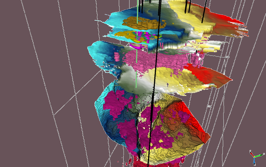
Reservoir Modeling
Looking for pay is what it is about and understanding the porosity slabs that have been detected in proximity to known and future production is crucial in seeing the big picture in understanding if our calibration to known production is valid throughout the volume. Making Geobodies of what we think are high porosity areas with fluid anomalies is used for report grade fast track of and volumetric estimates of potential reserves.

From the Map Perspective
Our final QC involves displaying our estimated anomalies in a report view for each lithology we are focusing on.